Big Piney River
No Records Found
Sorry, no records were found. Please adjust your search criteria and try again.
Google Map Not Loaded
Sorry, unable to load Google Maps API.
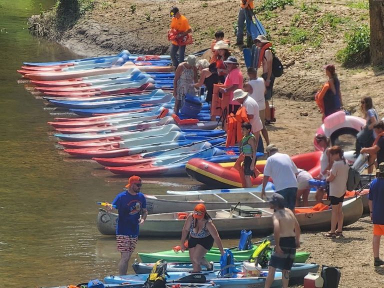
Big Piney River: Your Next Paddling Paradise!
Ready for a river adventure that’s equal parts relaxation and thrill? The Big Piney River—stretching 110 miles through the Ozarks—is a dream come true for floaters, anglers, and campers looking to soak up Missouri’s natural beauty. This winding waterway cuts through lush forests and towering bluffs, offering crystal-clear waters perfect for a lazy float or an exciting kayak trip. With plenty of gravel bars for pit stops, you can pull over, grill some burgers, and take a refreshing dip.
Famous for its smallmouth bass fishing, Big Piney is an angler’s paradise, but it’s also a haven for wildlife lovers—keep an eye out for playful otters and soaring bald eagles. The river flows through or near Houston, Fort Leonard Wood, and Licking, making it an easy getaway for outdoor enthusiasts. Whether you’re camping under the stars or paddling through breathtaking scenery, the Big Piney River is pure outdoor bliss. Grab your paddle and make some memories!
-
Family campground offering tent and RV camping; camp store; event center; Wi-Fi; dump station; cabin rentals; laundry; restroom; lighted boat ramp; grills; picnic tables; pavilion; bagged ice; fire wood; shower house. Ideal location for Scouts, organizations, family, church and military groups. Full-service canoe, raft, kayak, tube, and jon boat floats on the Big Piney River and the Gasconade River. https://www.bscoutdoors.com/ https://www.bscoutdoors.com/campground-info/driving-directions/ Read more...