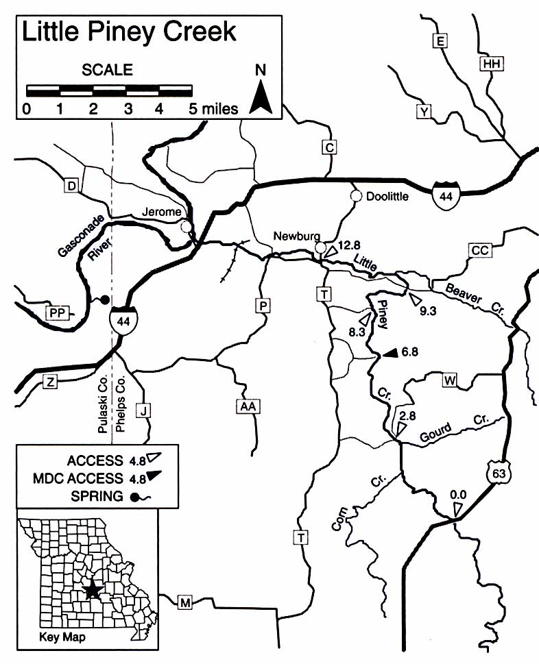
Little Piney Creek
Missouri’s Little Piney Creek
This tributary of the Gasconade is fed by many small springs, is a good fly-fishing stream and is frequently floatable with some wading. The lower 7.5 miles provide the best floating. The upper 10 miles is has a lower gradient and less water.
Difficulty: I and II.
Gradients: Hwy. 63 to Beaver Creek – 8.2: to Gasconade River – 9.4.
County: Phelps.

Little Piney Creek – Mile-By-Mile Description
0.0 Lane Spring has a daily flow of several million gallons. Forest Service Recrearion Area and campground. Enter from Hwy. 63 east of river.
1.5 Corn Creek on left.
2.6 Gourd Creek on right.
2.8 Hwy. W Bridge on County Road 7460
6.8 Milldam Hollow Access (Mark Twain National Forest) on left. Gravel bar. No ramp.
8.3 Access and Forest Service Recreation Area at end of County Road 7400.
9.3 Access at County Road 7360 Bridge berween Hwys. CC and T.
10.3 Beaver Creek on right.
12.8 Newburg Bridge on Hwy. T. Access at gravel bar below bridge on right.
14.4 Concrete ford on County Road 7530 berween Hwy. P and 1-44.
15.6 R.R. bridge.
17.0 1-44 bridges.
17.4 Gasconade River.
This is an electronic reprint of a Missouri Department of Conservation document. More or updated information on this topic can be found at the Missouri Department of Conservation web site located at: mdc.mo.gov. Copyright 2003 by the Conservation Commission of the State of Missouri.
Go to MCFA Home Page
